Floyd Drive Page
On this page you will find Information about the Current Culvert Repair and Replacement work that has been accomplished at Floyd Drive and the North Fork of Stickney and Additional Information
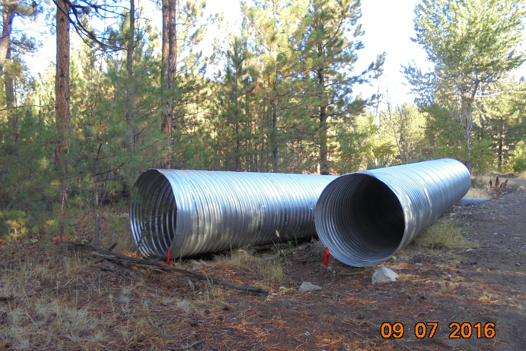
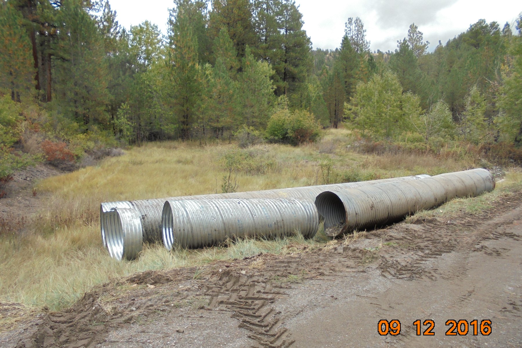
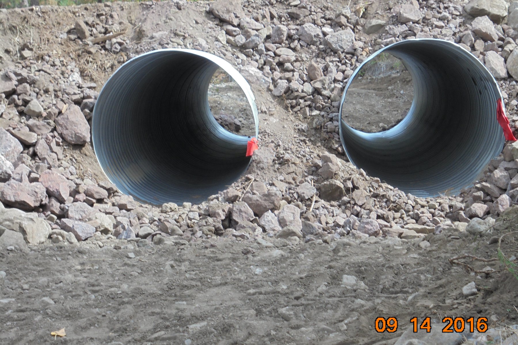
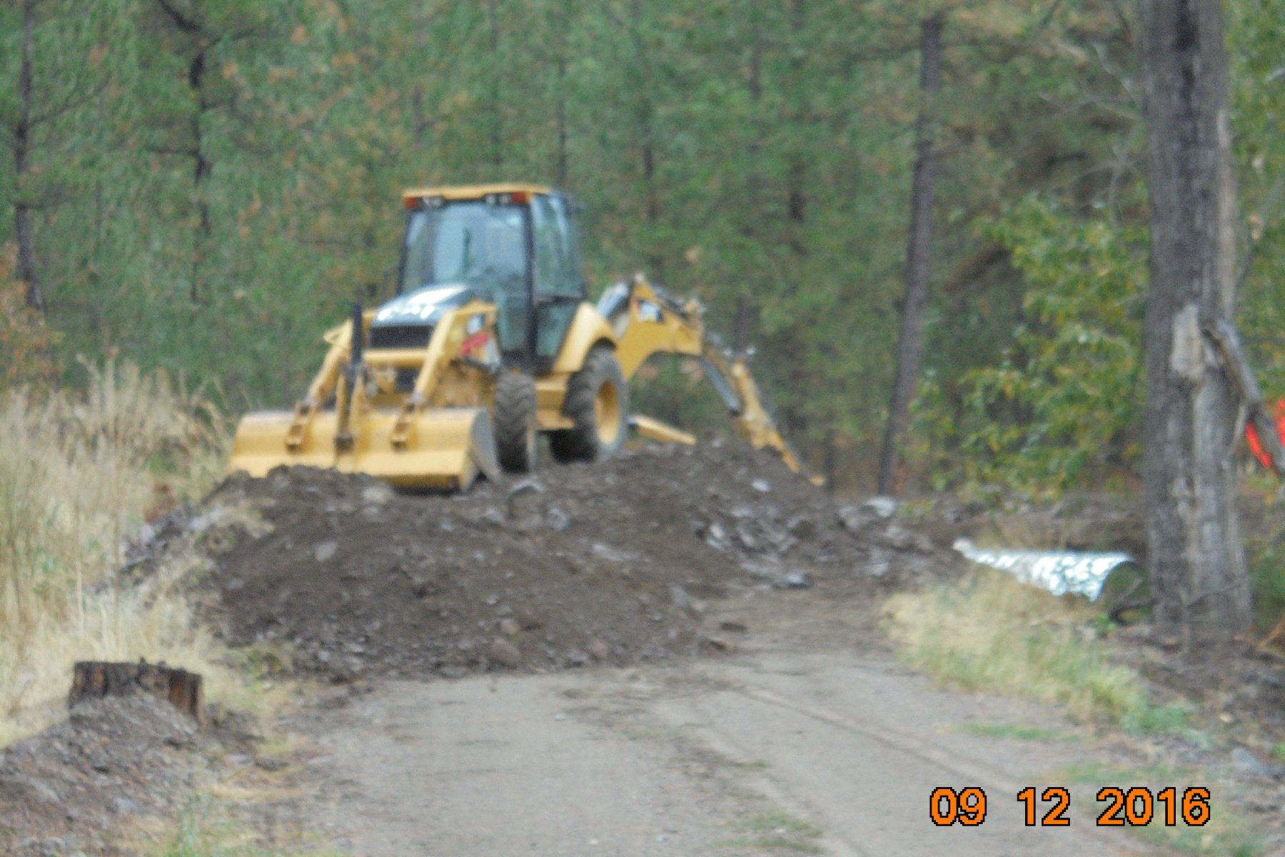
On September 12th and 13th 2016 the culverts you see below were installed at Floyd Drive and the North Fork of Stickney Creek. These culverts are 30 feet in length and 5 feet in diameter and replaced the previous culverts which were installed in June of 2015.The 3 foot diameter, 30 and 34 foot length culverts shown below were removed.
Some Information Contained on this Page was Obtained through Freedom of Information Act Requests and Verified for Public Distribution though the Montana Freedom of Information Hotline Inc.
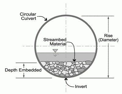
As specified in the Application to the Army Corps of Engineers (ACOE) and the Lewis and Clark County Conservation District (LCCD) (DNRC - Montana) made by Deanna Lane - MRR-ECR Landowners Association Secretary Treasurer the Culverts were to be Embedded into the streambed 18 to 20 inches.
As required by the Permit issued by the ACOE "the culverts will be countersunk into the streambed approximately 18-inches to facilitate sediment transport". The LCCD Permit required "Embed the culverts 20% to keep them from being perched and allowing them to pass bedload". See ACOE and LCCD pages for more detailed information.
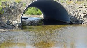
The newly installed culverts (See Photos Below) appear to be only partially embedded.
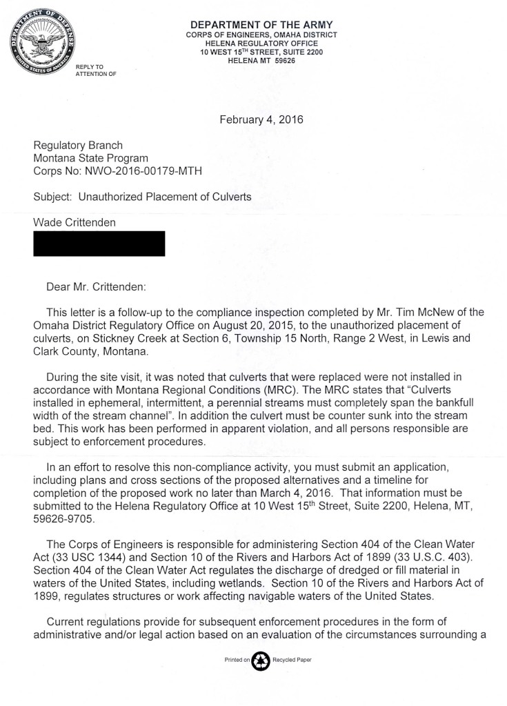
The original letter "Unauthorized Placement of Culverts from the Army Corps of Engineers (below) (obtained through a FOIA request) was specific in requiring "the culvert must be counter sunk into the streambed"
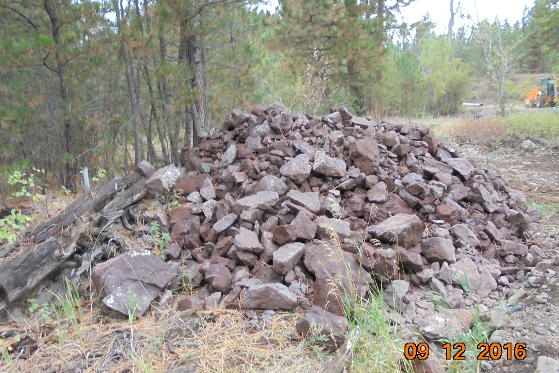
The 5 foot Diameter Culverts along with 30 yards of Rip-Rap (rock) (see photo below) and other resources were contributed by Mr. Mark Pieloch owner of Lot 25 and other numerous properties in the area. Lot 25 is where Floyd Drive and the North Fork of Stickney Creek meet. Mr Pieloch contributed these resources (at his own expense) in an effort to help the Landowners resolve the culverting issues that have been created over the last 5 years at Floyd Drive which he had nothing to do with. Mr Pieloch had no control of the installation of the 5 foot diameter culverts as this was accomplished by a Contractor.
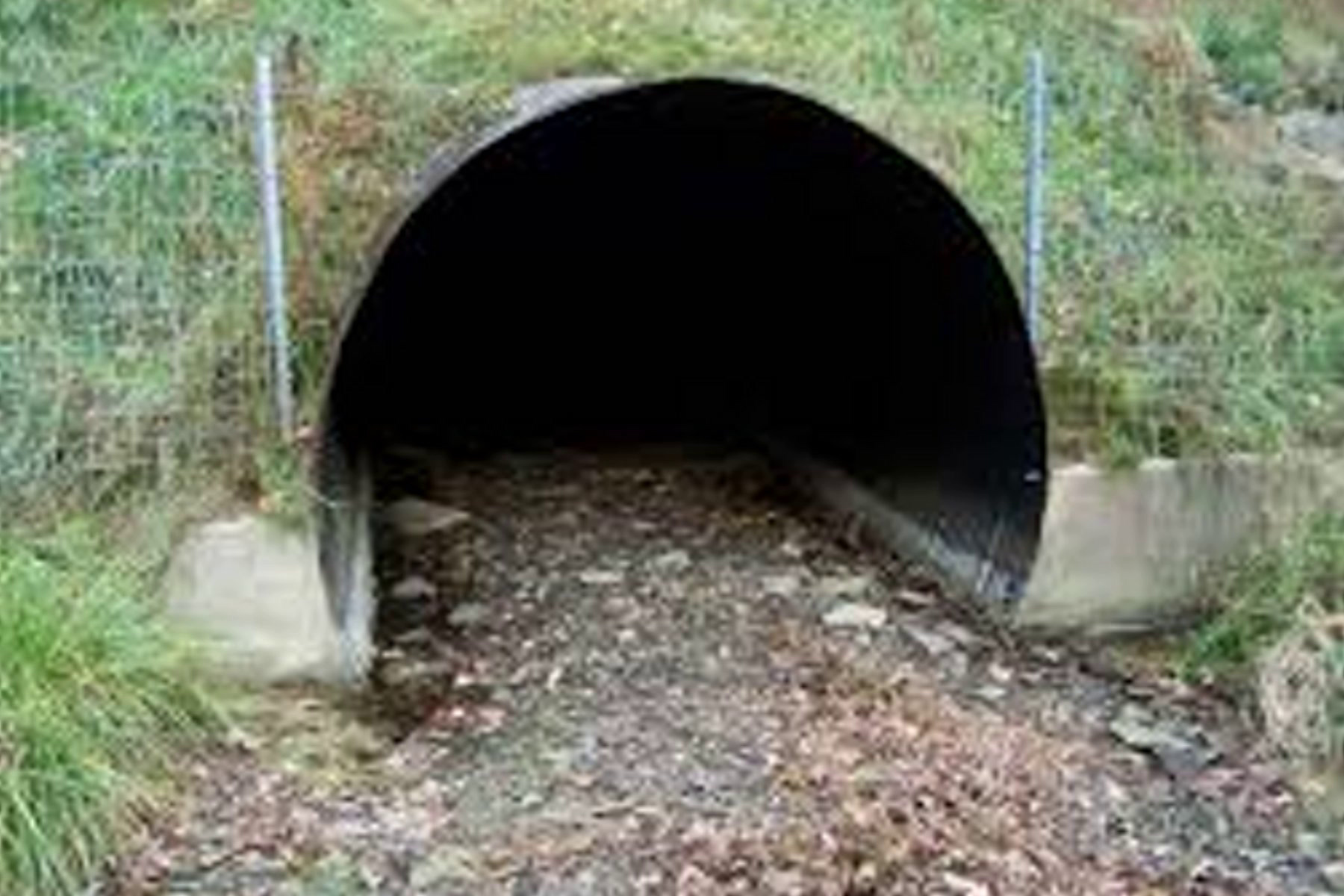
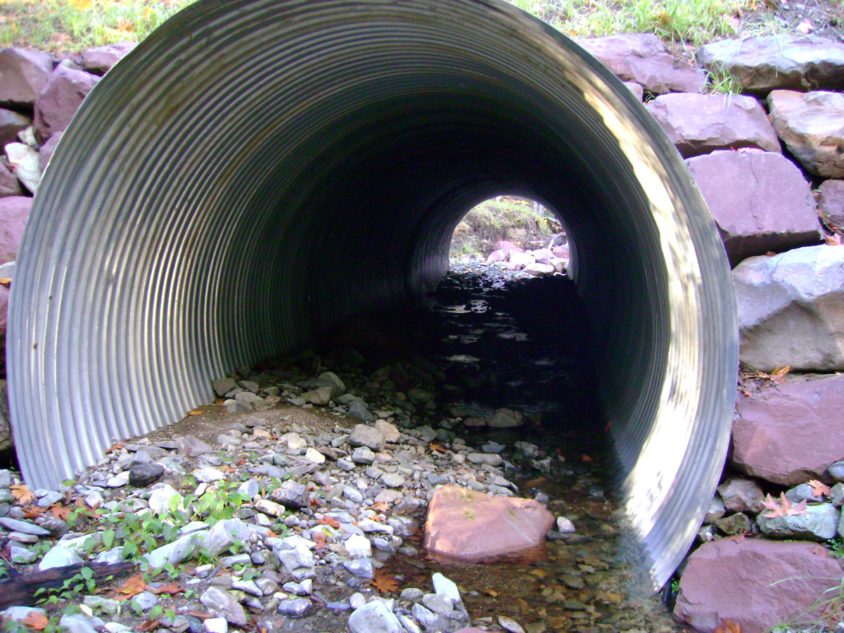
Correctly embedded culverts prevent Perching to reduce channel/stream erosion, mimic natural stream flow and help stabilize the culvert(s).
In addition, correctly embedded culvert(s) help reduce Upstream and Downstream Erosion and Prevent Future Washouts . Reducing the cost of future maintenance and repair costs required from Landowner Fees.
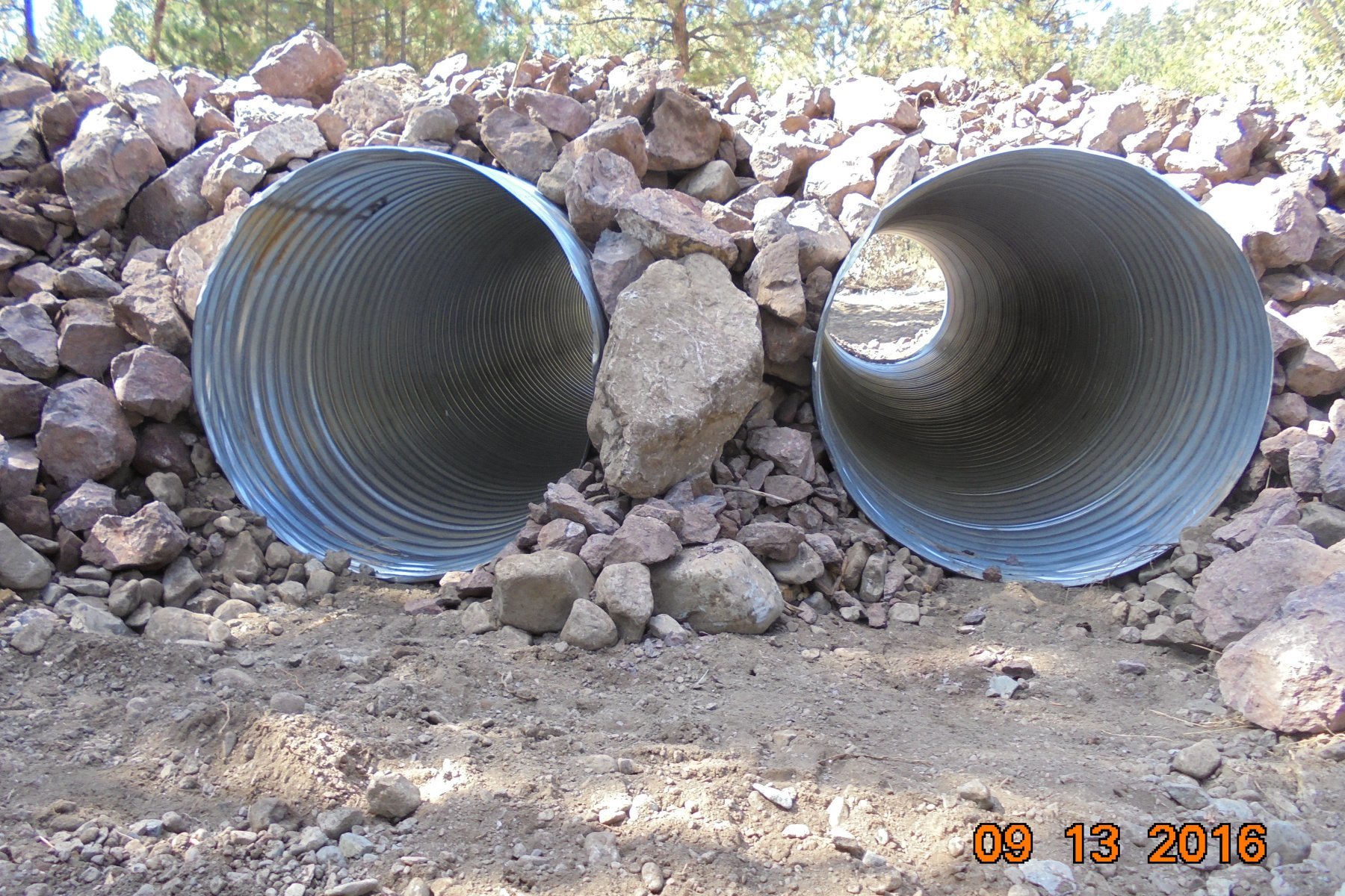
The photos below are of the culverts that have recently been installed at Floyd Drive. The culverts were embedded approximately 18 inches in the streambed. This was done correctly.
However the Embedment was not completed since streambed material is not
embedded inside the culvert or at the inlet or outlet ends of the culvert(s)
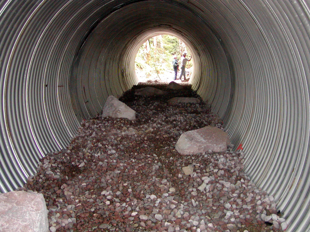
Correctly Embedded Culvert
Correctly Embedded Culvert
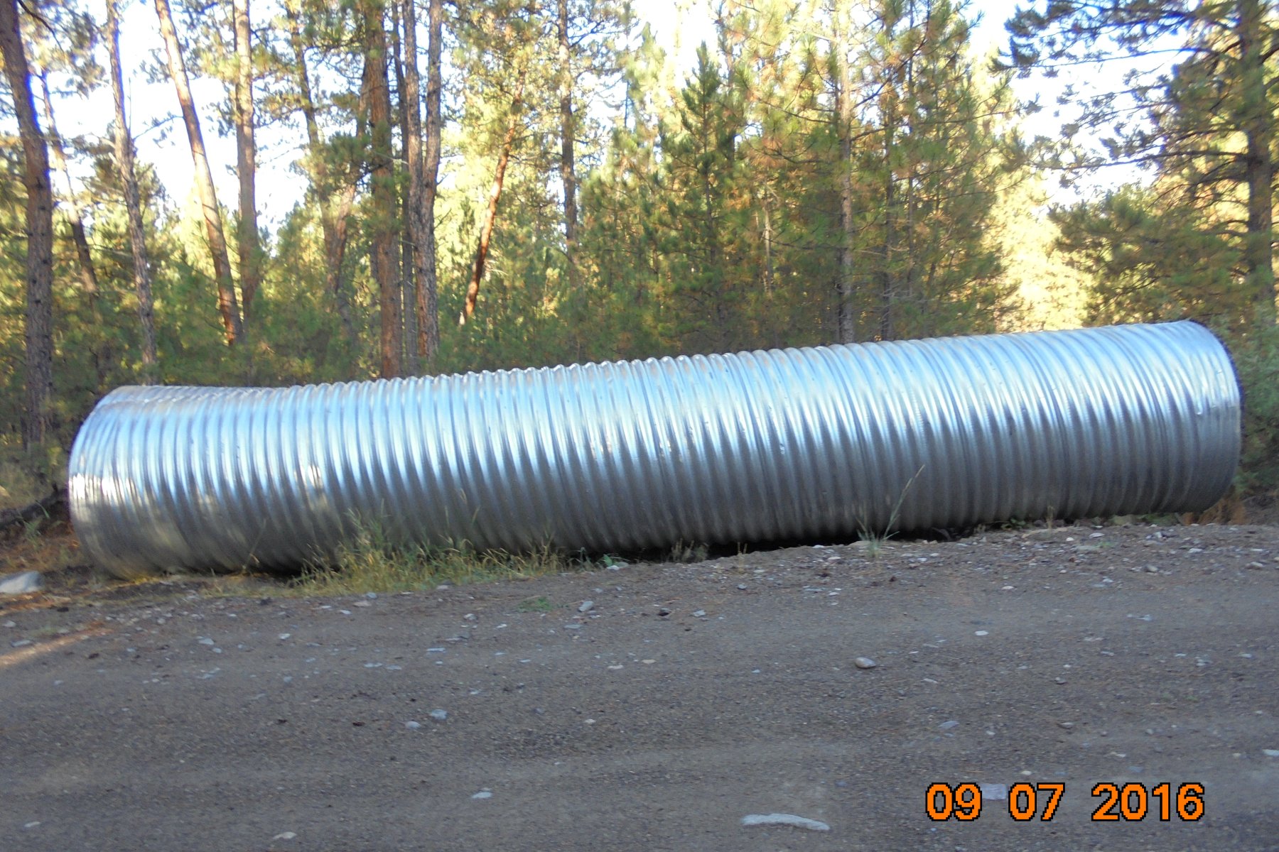
Recently Installed Culvert(s) at Floyd Drive
Recently Installed Culvert(s) at Floyd Drive
Correctly Embedded Culvert
Rip-Rap (Rock)
5 foot diameter 30 foot long culverts before installation
Removed 3 foot Diameter Culverts. These were paid for with Landowners Fees. They have since been removed from this location, whereabouts unknown.
Click here to add text.
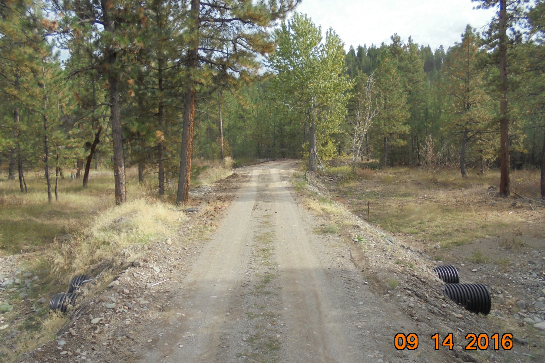
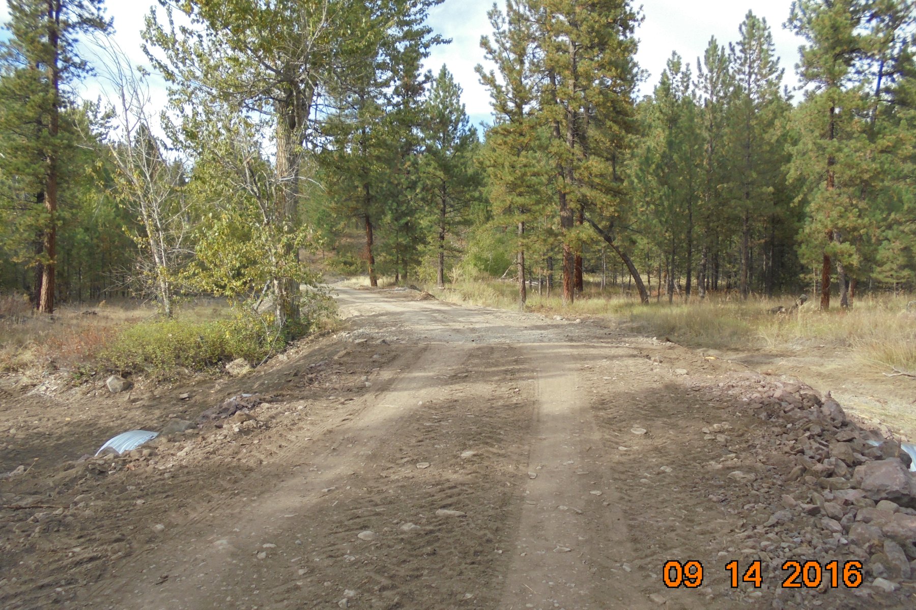
Below are Photos of Floyd Drive. The Permit issued by the Lewis and Clark Conservation District (DNRC) required "incorporate a reinforced overflow channel into the road (in other words, a reinforced depression in the road) to pass flood flows". It was also stated by the LCCD in an amended permit "incorporate a reforced overflow "dip" in the road to pass overflows more effectively: It would appear the work at Floyd Drive has been completed and no overflow relief has been incorporated into the road.
Floyd Drive looking North. No Overflow Channel
Floyd Drive looking South. No Overflow Channel
Amended Permit From the Lewis and Clark Conservation District
Click 'ON' the Menu Tabs Above to View other Pages
LCCD = Lewis and Clark Conservation District
ACOE = Army Corps of Engineers
MRR = Missouri River Ranches Landowners Corporation
ECR = Eagle Canyon Ranch
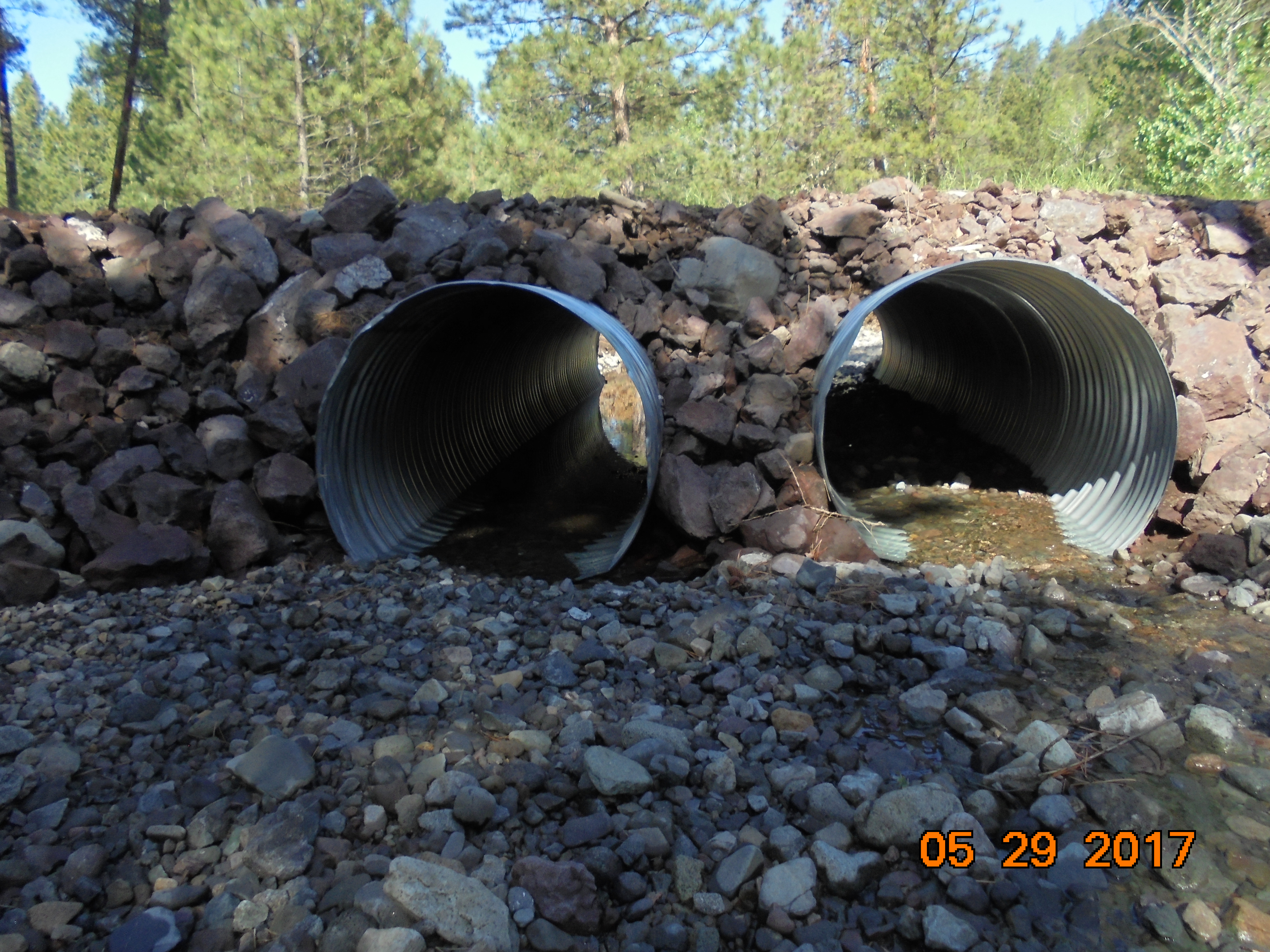
The photo on the Left shows the Culverts installed at Floyd Drive are beginning to fill with sediment and rock. The permit requires the Culverts to be imbedded into the stream bed 20 percent. This means the Culverts need to be filled approximately 20 percent with sediment and Rock which is clearly not the case here.
 | ||||||